List of Most Dangerous Earthquakes Ever Recorded in History
This list provides information about earthquakes in all parts of the world, which are handed down through historical reports or because of their impact through media reports. The preconceived map shows the concentration of earthquake epicentres along the tectonic plate boundaries.
Earthquakes that occur under the seabed are often referred to as “seaquakes” or “seaquakes”. If, in this case, raised areas and / or depressions occur over large areas, large volumes of seawater are displaced jerkily. The energy is spread out over water waves and carries the additional danger of tsunamis on coasts.
Here is the list of the 10 Most Powerful Earthquakes Ever Recorded:-
10. 1833 Sumatra earthquake
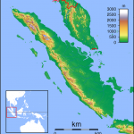
- Topographic locator map of Sumatra.
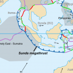
- Detailed map in English showing the tectonic plates with their movement vectors, with label added for Sunda megathrust.
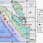
- USGS image depicting en:earthquake zones for the Sunda Trench
| Rank: 10 |
| Date: November 25, 1833 |
| Location: Sumatra, Indonesia |
| Magnitude: 8.8 |
| Casualties: unknown |
| Duration: 5 minutes |
The earthquake in Sumatra occurred on November 25, 1833, at approximately 22:00 local time, with an estimated magnitude of M w = 8.8 to 9.2. This caused a great tsunami that flooded the southwestern coast of the island. There are no reliable records of loss of life, but it is described as numerous victims. The magnitude of this event has been estimated using the elevation records taken from the micro-atoll coral.
9. 1762 Arakan earthquake
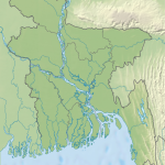
- Location map of Bangladesh
| Rank: 9 |
| Date: April 2, 1762 |
| Location: Chittagong, Bangladesh |
| Magnitude: 8.8 |
| Casualties: 200 |
| Duration: 4 minutes |
The 1762 Arakan earthquake occurred at about 17:00 local time on 2 April, with an epicentre somewhere on the coast from Chittagong (modern Bangladesh) to Arakan in modern Burma. It had an estimated magnitude of as high as 8.8 on the moment magnitude scale and a maximum estimated intensity of XI (Extreme) on the Mercalli intensity scale. It triggered a local tsunami in the Bay of Bengal and caused at least 200 deaths. The earthquake was associated with major areas of both uplift and subsidence. It is also associated with a change in course of the Brahmaputra River to from east of Dhaka (Old Brahmaputra River) to 150 km to the west via the Jamuna River.
8. 869 Sanriku earthquake
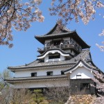
- Castle of the Japanese City of Inuyama in Aichi Prefecture.
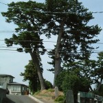
- The pine trees of “Sue no Matsuyama” in Tagajō-shi, Miyagi prefecture
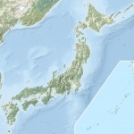
- Japan natural location map with side map of the Ryukyu Islands
| Rank: 8 |
| Date: July 9, 869 |
| Location: Pacific Ocean, Tōhoku region, Japan |
| Magnitude: 8.9 |
| Casualties: ≈1,000 |
Basierend auf den beschriebenen Schäden für diesen Ort, die auf eine seismische Intensität von mindestens der Stufe 5 schließen lassen, wird vermutet, dass das Erdbeben eine Magnitude von 8,3 hatte. Eine Simulation durch Minoura et al. von 2001 lokalisierte das Erdbeben zwischen 37° und 39° N, 143° und 144,5° O, wobei die Verwerfung etwa 200 km lang, 85 km breit war und in 1 km Tiefe stattfand. Der Tsunami besaß demnach dann eine Höhe von etwa 8 m. Satake et al. bestimmten 2008 die Verwerfung mit einer Länge von 100 bis 200 km und einer Breite von 100 km bei einer Momenten-Magnitude MW 8,1 bis 8,4. Die Erdbeben-Datenbank des National Geophysical Data Center der US-amerikanischen NOAA gibt eine Oberflächenwellen-Magnitude von MS 8,6 an.
Geologische Untersuchungen fanden marine Sedimentablagerungen, die auf diesen Tsunami zurückzuführen sind, in der Ebene zwischen dem heutigen Sendai und Sōma mehr als 4–4,5 km landeinwärts. Allerdings lag die Ebene damals etwa einen halben Meter niedriger als heute. Dies bestätigt die beschriebenen großflächigen Überflutungen und die hohe Zahl der Todesopfer (verglichen mit der Tatsache, dass die Gegend damals weit weniger und nur sehr verstreut besiedelt war). So wird für das 8. Jahrhundert für diese zweitbevölkerungsreichste Provinz eine Bevölkerung von 186.000 angenommen.
Zudem wurden Hinweise auf zwei ähnlich verheerende, vorangegangene Tsunamis mit ähnlichen Auswirkungen gefunden: einen zwischen 910 und 670 v. Chr. und einen zwischen 140 v. Chr. und 150 n.Chr. Basierend darauf wird angenommen, dass derartige Tsunamis diese Küstengegend etwa alle 800 bis 1100 Jahre, bzw. unter Hinzunahme des Keichō-Sanriku-Erdbebens 1611 alle 450–800 Jahre treffen. Minoura et al. meinten 2001, dass ein ähnlich starker Tsunami, der etwa 2,5–3 km ins Land eindringe, zu erwarten sei. Diese Vorhersage wurde häufig mit dem Tōhoku-Erdbeben und -Tsunami vom 11. März 2011 identifiziert und dieses wiederum dem Jōgan-Erdbeben 869 gleichgestellt.
7. 1700 Cascadia earthquake
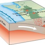
- Subduction process of the Juan de Fuca Plate in Oregon, USA as a cutaway graphic
- The earthquake of Valparaiso of 1906 was an earthquake registered the 16 of August of 1906 to the 19:48 local time. Its epicenter was located in Region V of Valparaíso, Chile, and had a magnitude of 7.9º on the Richter seismological scale.
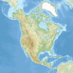
- Relief location map of North America.
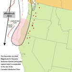
- Cascadia subduction zone.
| Rank: 7 |
| Date: January 26, 1700 |
| Location: Pacific Ocean, USA and Canada |
| Magnitude: 8.7–9.2 |
The Cascadia earthquake of 1700 was a mega-shooter between 8.7 and 9.2 on the momentum scale, which occurred in the Cascadia subduction zone on January 26, 1700. In the earthquake were involved the Plate of Juan de Fuca and the Pacific Plate from the island of Vancouver in Canada to the northern coast of California in the United States. The breakage size of the fault was estimated at about 1000 kilometers with a slip of at least 20 meters.
The subsequent tsunami struck the east coast of Japan.
The earthquake originated at 21:00 on January 26, 1700, although there are no exact records of the time and even of its occurrence. Indigenous texts reveal that a major earthquake occurred, as did Japanese records claiming that large quantities of red cedar were killed by the pre-tsunami sea retreat.
6. 1868 Arica earthquake
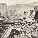
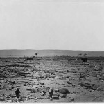
- Arica after the earthquake and tsunami
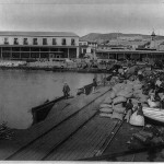
- Photograph shows passengers and cargo on the wharf at Arica, Chile (formerly Peru), with mountains in the background.
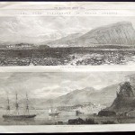
- Peru Earthquake in Arica 1868. The Illustrated London News South America – Peru ‘The Late Earthquake in South America: Ruins of Arica, in Peru & Ruins of Arica from the Sea’ October 24, 1868.
- Arica after the earthquake (1868)
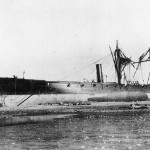
- Peruvian corvette America, wrecked by the tsunami triggered by the 1868 Arica earthquake – gunboat USS Wateree visible in the background
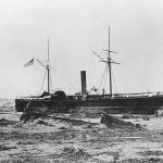
- USS Wateree (1863) beached at Arica, Chile, 430 yards above the usual high water mark, after she was deposited there by a tidal wave on 13 August 1868.
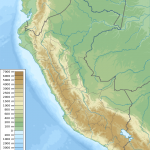
- Peru physical map
| Rank: 6 |
| Date: August 13, 1868 |
| Location: Arica, Chile (then Peru) |
| Magnitude: 8.5–9.0 |
| Casualties: 25,000+ |
| Duration: 5-10 minutes |
| Max. intensity: XI (Extreme) |
The earthquake of Arica of 1868 was an earthquake registered the 13 of August of 1868 near the 16:00 local time. Its epicenter was located at -18,500, -70,350 off the coast of Arica, the present capital of Arica and Parinacota Region, Chile (then capital of the Province of Arica, Department of Moquegua, Peru) and estimated Which released an energy equivalent to an earthquake of 9.0 Mw.
The earthquake event devastated much of southern Peru, especially the cities of Arequipa, Moquegua, Tacna, Islay, Arica and Iquique (the latter two currently in Chile). The earthquake was also perceived differently between Lambayeque in the north and Valdivia in the south, and even Cochabamba in Bolivia. Following the main movement, a tsunami swept the Peruvian coasts between Pisco and Iquique and crossed the Pacific Ocean, reaching even California, the Hawaii Islands, the Philippines, Australia, New Zealand and Japan.
The estimated death toll would reach 30 people in Chala, 10 in Arequipa, 150 in Moquegua, 3 in Tacna, 300 in Arica and 200 in Iquique.
5. 1952 Severo-Kurilsk earthquake
- Russia edcp location map
- Russia edcp relief location map
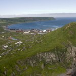
- SevKur heli View
| Rank: 5 |
| Date: November 4, 1952 |
| Location: Kamchatka, Russian SFSR, Soviet Union |
| Magnitude: 9.0 |
| Casualties: 2,336 dead |
| Tsunami: 18 m (59 ft) |
The main earthquake occurred at 16:58 GMT (4:58 local time) on November 4, 1952. Initially assigned a magnitude of 8.2, the earthquake was revised to 9.0 Mw in recent years. A large tsunami resulted, causing the destruction and loss of life around the Kamchatka peninsula and the Kuril islands. Hawaii was also hit, with estimated damages of up to $ 1 million and livestock losses, but no human casualties were reported. Japan also reported no casualties or damage. The tsunami hit places as far as Alaska, Chile and New Zealand.
The hypocenter was located at 52.75 ° N 159.5 ° E, at a depth of 30 km. The length of the fracture subduction zone was 600 km. Replicas were recorded in an area of approximately 247,000 km2 with an epicenter at a depth of km between 40 and 60. A recent analysis of the distribution of the tsunami on the basis of historical and geological records gives some indications about the slip breaking off.
4. 2011 Tōhoku earthquake and tsunami
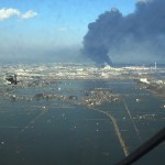
- An aerial view of the Sendai region with black smoke coming from the Nippon Oil refinery
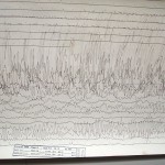
- A seismogram recorded in Massachusetts, USA
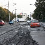
- Soil liquefaction in Kōtō, Tokyo
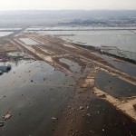
- Tsunami flooding on the Sendai Airport runway
- Aerial photo of Minato, devastated by both the earthquake and subsequent tsunami
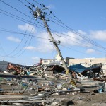
- Damaged utility pole in Ishinomaki
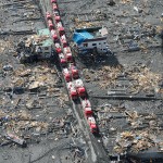
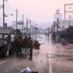
- Emergency vehicles staging in the ruins of Sukuiso, Japan following the tsunami
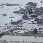
- Rescue operations in the floodwaters in downtown Ishinomaki
| Rank: 4 |
| Date: March 11, 2011 |
| Location: Pacific Ocean, Tōhoku region, Japan |
| Magnitude: 9.1 |
| Casualties: 15,894 deaths, 6,152 injured, 2,562 people missing |
| Duration: 6 minutes |
| Depth: 29 km (18 mi) |
| Total damage: US$14.5 to $34.6 billion |
The 2011 earthquake of the Pacific coast of Tōhoku in Japan is a magnitude 9.0 earthquake that occurred off the northeast coast of Honshū Island on March 11, 2011. Its epicenter is located at 130 Km east of Sendai, capital of Miyagi Prefecture, in the Tōhoku region, located about 300 km northeast of Tokyo. The maximum seismic intensity is recorded at Kurihara and is 7 on the Shindo scale (highest grade). It spawned a tsunami whose waves reached a height estimated at more than 30 m in places. They have traveled up to 10 km inland, ravaging nearly 600 km of coastline and partially or totally destroying many towns and harbor areas.
However, this earthquake of magnitude 9 is responsible for only a few victims and damage due to the quality of Japanese earthquake resistant construction. The magnitude of the disaster is largely due to the tsunami that followed, which is responsible for more than 90% of the 18,079 deaths and missing persons, destruction and injuries. This tsunami also resulted in the Fukushima nuclear accident placed at level 7, the highest on the international scale of nuclear events (INES) of nuclear and radiological accidents.
The reconstruction will take several years and its estimated cost is already the most expensive earthquake in history after that of Kobe in 1995. Estimated economic losses are in the order of $ 210 billion.
3. 2004 Indian Ocean earthquake and tsunami
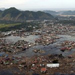
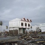
- A village near the coast of Sumatra lays in ruin after the Tsunami that struck South East Asia
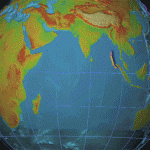
- Animation of tsunami caused by the earthquake showing how it radiated from the entire length of the 1,600 km (990 mi) rupture
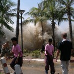
- The tsunami strikes Ao Nang, Thailand.
- A two-story house damaged by the tsunami showing the tsunami inundation height in downtown Banda Aceh.
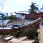
- Fishermen’s boat stranded in Kallady, Batticaloa, Sri Lanka.
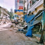
- Tsunami destruction in Chennai, Tamil Nadu, India.
- Patong Beach, Thailand, after the tsunami
- German tsunami relief mission team members of AGSEP visiting tsunami-hit Mullaitivu in Northern Province, Sri Lanka in January 2005
| Rank: 3 |
| Date: December 26, 2004 |
| Location: Indian Ocean, Sumatra, Indonesia |
| Magnitude: 9.1–9.3 |
| Casualties: 230,000–280,000 dead and more missing |
| Duration: 8.3 and 10 minutes. |
| Depth: 30 km (19 mi) |
The earthquake in the Indian Ocean, also known as the Sumatra Andaman quake, on 26 December 2004 at 00:58 UTC (07:58 UTC time in West Indonesia and Thailand) was a submarine megathrust earthquake with a magnitude of 9, 1 and the epicenter 85 km off the northwest coast of the Indonesian island of Sumatra. It was the third largest ever recorded quake and triggered a series of devastating tsunamis on the coasts of the Indian Ocean. Tourists spent their Christmas holidays on many coastal sections; On the beaches were many people for sunbathing and bathing. In total, the earthquake and its consequences killed some 230,000 people, of whom 165,000 alone were living in Indonesia. Over 110,000 people were injured, over 1.7 million coastal inhabitants around the Indian Ocean were homeless. The event was exceptionally well documented: many tourists had a videocamera to hand or a digital camera, which could also film.
2. 1964 Alaska earthquake
- A winter scene of a “Ghost forest” that was killed and preserved by salt water along with ruined buildings at the site of the former town of Portage, 2011
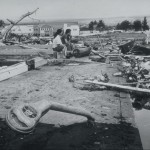
- A plank driven through a tire by the tsunami in Whittier
- The ruin of Portage
- The largest landslide in Anchorage occurred along Knik Arm between Point Woronzof and Fish Creek, causing substantial damage to numerous homes in the Turnagain-By-The-Sea subdivision.
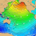
- Calculated travel time map for the tectonic tsunami produced by the 1964 Prince William Sound earthquake in Alaska. Red: 1- to 4-hour arrival times, Yellow: 5- to 6-hour arrival times, Green: 7- to 14-hour arrival times, Blue: 15- to 21-hour arrival times.
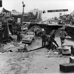
- Fourth Avenue in Anchorage, Alaska, looking east from near Barrow Street.
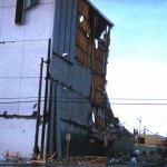
- The 5-story JCPenney department store in Anchorage in 1964, following the earthquake.
| Rank: 2 |
| Date: March 27, 1964 |
| Location: Prince William Sound, Alaska, United States |
| Magnitude: 9.2 |
| Casualties: 139 killed |
| Duration: 4-5 minutes. |
| Depth: 25 kilometres (16 mi) |
| Total damage: $311 million |
The Good Friday quake, also known as the Great Alaska Quake, was the strongest single earthquake in the history of the United States. After the earthquake of Valdivia in 1960 it was the earthquake with the second highest magnitude since the beginning of the regular recording of earthquakes carried out from around 1950 onwards.
It occurred on March 27, 1964 at 5:36 pm local time (March 28, 03:36 UTC) and had a moment magnitude of MW 9.2. The epicenter was located in Prince William Sound in southern Central Alaska. Most of the damage occurred in Anchorage, 120 kilometers northwest of the epicenter.
By the quake, 125 people were killed, almost all by tsunamis, which reached the fjords of the Prince William Sound and the Kenai Peninsula and reached a maximum height of about 67 meters. Victims were also reported from California and Oregon. The quake lasted nearly three minutes in Anchorage. The biggest destruction in the city was caused by landslides and massive land shifts. Nearly every house near the Turnagain Heights was destroyed by the quake.
In the novel The smell of houses of other people of the American-American Bonnie-Sue Hitchcock from 2016, the quake plays an essential role, in that it plays a vital role for some of the youthful protagonists, because of the dying death of their father.
1. 1960 Valdivia earthquake
- South America laea relief location map
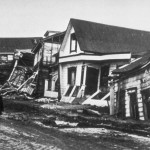
- Valdivia after earthquake, 1960
- Great Chilean Earthquake damage at Kamaishi
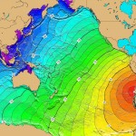
- Tsunami travel time Valdivia 1960
- Hilo after Tsunami
- Cordon Caulle eruption
- The center of Corral was almost completely destroyed by a tsunami – Autumn 1960
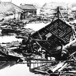
- Destroyed steel factory near Corral – Photo from the autumn of 1960
| Rank: 1 |
| Date: May 22, 1960 |
| Location: Valdivia, Chile |
| Magnitude: 9.4–9.6 |
| Casualties: 1,000–7,000 |
| Duration: 11–13 minutes |
| Depth: 33 km (21 mi) |
| Total damage: US$400 million to 800 million |
The earthquake of Valdivia on May 22, 1960, also known as the Great Chile Earthquake, was the earthquake with the world’s largest ever recorded magnitude and the heaviest earthquake of the 20th century. At 3:11 pm local time (19:11 UT), the quake on the moment magnitude scale reached a value of Mw 9.5. The topographic shape of large areas of the Little South of Chile was changed, especially the area around the provincial capital Valdivia.
The earthquake triggered a tsunami, which caused serious destruction throughout the Pacific. An estimate of the United States Geological Survey (USGS) is about 1,655 deaths, 3,000 injured and two million homeless.
